
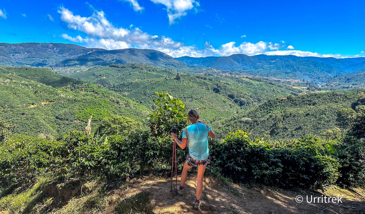

I will be honest from the first line: El Camino de Costa Rica is hard. It is not a Sunday stroll or a beach walk. But it is not an expedition for athletes either. People in their 20s, their 50s and their 70s finish it. Our oldest hiker completed it at 82.
After 8 years working and living on El Camino, I know exactly where it gets tough and what makes the difference between suffering through it and enjoying it. Here it is, with official data, stage by stage.
Quick answer: how hard is El Camino de Costa Rica?
- Total elevation gain: about 9,460 m if you add up every stage, more than climbing Everest from sea level (the commonly quoted figure is about 7,250 m).
- Difficulty mix: of the 17 sections, 4 are beginner, 10 intermediate and 3 advanced.
- Daily distance: 6 to 23 km per day, in 4 to 8 hour days.
- Hardest part: the constant ups and downs, the humid heat and walking day after day, not the altitude (high point about 2,350 m).
- Who finishes it: trained hikers from their 20s to their 80s, with 8 to 12 weeks of preparation.
The short answer
- The hard part is not altitude, it is the ups and downs. The high point is about 2,350 m, but you climb about 9,460 m in total when you add up the official stage data, more than climbing Everest from sea level.
- Only 3 of the 17 sections are advanced. 4 are beginner level and 10 are intermediate.
- You walk 6 to 23 km a day, in 4 to 8 hour days.
- The weather matters as much as the hills: humid heat on the Caribbean side, mud in the rainy season and cold in the mountains.
Elevation, stage by stage
This is the official data from the Mar a Mar Association. In bold, the numbers your legs will feel most.
| Stage | Section | Gain (m) | Loss (m) | Official level |
|---|---|---|---|---|
| 1A | Barra de Parismina to Muelle Goshen | 1 | 2 | Beginner |
| 1B | Muelle Goshen to Cimarrones | 104 | 0 | Intermediate |
| 2 | Cimarrones to Las Brisas | 725 | 196 | Intermediate |
| 3 | Las Brisas to Tsiobata | 550 | 664 | Advanced |
| 4 | Tsiobata to Tres Equis | 441 | 271 | Intermediate |
| 5 | Tres Equis to Pacayitas | 517 | 257 | Beginner |
| 6 | Pacayitas to La Suiza | 371 | 690 | Intermediate |
| 7 | La Suiza to Pejibaye | 728 | 594 | Intermediate |
| 8 | Pejibaye to Tapantí (Purisil) | 1,165 | 610 | Intermediate |
| 9 | Purisil to Navarro del Muñeco | 932 | 934 | Intermediate |
| 10 | Navarro del Muñeco to Palo Verde | 653 | 379 | Advanced |
| 11 | Palo Verde to Cerro Alto | 928 | 324 | Advanced |
| 12 | Cerro Alto to San Pablo | 406 | 992 | Intermediate |
| 13 | San Pablo to Nápoles | 260 | 275 | Intermediate |
| 14 | Nápoles to Naranjillo | 364 | 1,067 | Beginner |
| 15 | Naranjillo to Esquipulas | 950 | 1,464 | Beginner |
| 16 | Esquipulas to Quepos | 365 | under 50 | Intermediate |
| TOTAL | 17 sections | about 9,460 | about 8,770 | 4 beginner, 10 intermediate, 3 advanced |
Stage 16 only has small dips, under 50 m in total. The commonly quoted overall figure is about 7,250 m of gain. Adding up the stage-by-stage data gives more, because it counts every small climb.
The 5 stages that deserve the most respect

Stage 3: Cabécar territory (the wildest)
An unmarked, rocky, muddy trail, with sections that have no GPS signal and the Pacuare River crossing in a hanging basket (andarivel). That is why a local guide is required. It is not the biggest climb, but it is the most technical.

Stage 8: the biggest climb
More than 1,100 meters of total gain toward Tapantí. It is mostly on rural roads, so the challenge is endurance, not technique. This is where you pass the halfway point.

Stages 10 and 11: “the family”
Both are advanced: steep climbs, a rain-washed track and dense forest above 2,200 m. Stage 11 is nothing but climbs, and I call them “the family”: every hill is a family member. I walk ahead shouting “Here comes Mom!”, “Now it is the aunt!”, “Watch out for the chihuahua!”, all the way up to the biggest, toughest one of all: Grandma. Between the laughs, the climb feels a lot shorter.

Stage 15: the knee trap
It is officially beginner level, but watch out: it has almost 1,500 meters of descent. Long descents are more tiring than they look, and they are where blisters and sore knees show up. Use poles and take short steps.
What makes El Camino hard (and is not on the map)
- Heat and humidity: on the Caribbean stages and the final approach to Quepos you walk in over 30 degrees Celsius with little shade. Carry at least 2 liters of water.
- Mud: in the green season some trails get slippery. Boots with good grip are a must.
- Rivers: the Pacuare River is crossed in a hanging basket (andarivel) pulled across the water. Thrilling, but not for anyone afraid of heights.
- Back-to-back days: one stage is manageable. The challenge is stringing together 12 to 16 days without a break.
- Navigation: trail marking is inconsistent. With a guide it is a non-issue. On your own you need the GPS track.
Are you ready? Take this test
If you answer “yes” to most of these, you can do El Camino:
- Can you walk 15 km in one go without trouble?
- Can you climb 500 meters of elevation in a morning at your own pace?
- Can you hike two or three days in a row and feel fine the next morning?
- Do you have at least 8 to 12 weeks to train before your trip?
- Do you handle heat and humidity well?
If you said “no” to more than 3 of those questions do not be discouraged: the 8-day Essentials tour or hiking El Camino in sections are great ways to start and with luggage transfer you only carry a daypack, which changes everything. This itinerary focuses on the highlights and most memorable parts of the trail, providing a shorter but impactful experience.
How to make it easier
- Train with elevation, not just distance: stairs, local hills and weekend hikes with a pack. Lear How to physically prepare for El Camino de Costa Rica
- Use trekking poles, especially for the descents on stages 12 to 15.
- Hike light: luggage transfer saves you carrying 10 kg up every climb.
- Start early: leaving at 6 a.m. beats the heat and the afternoon rain.
- Find your pace: it is not a race, How to choose the best hiking pace
Harder than the Camino de Santiago
If you have walked the Camino de Santiago, expect something more demanding: Costa Rica’s Camino has more elevation, more heat, less trail marking and rivers to cross. In return you get rainforest, volcanoes, wildlife and the hospitality of rural communities that tourists almost never reach.
Walk it with company
With URRITREK you hike with a guide certified in wilderness first aid, your luggage transferred between stages and someone who knows every hill (and its name). Choose from 8, 11, 14 and 16-day itineraries with guide, lodging, meals and luggage transfer included.
Community-Based Travel: The Heart of Hiking El Camino de Costa Rica

FAQ
How hard is El Camino de Costa Rica?
It is demanding mainly because of the total elevation gain, the humid heat and the back-to-back days. You climb about 9,460 m across the full route when you add up every stage (the commonly quoted figure is about 7,250 m), more than Everest from sea level. Of its 17 sections, 4 are beginner level, 10 intermediate and 3 advanced.
What is the hardest stage of El Camino de Costa Rica?
Stage 3, in Cabécar territory, is the most technical: unmarked, rocky and muddy, with a river crossing in a hanging basket. Stages 10 and 11 have the steepest climbs, and stage 8 has the most total elevation gain, more than 1,100 m.
Do I need mountain experience to hike El Camino de Costa Rica?
You do not need to be a mountaineer, but you do need to be in good shape and train with elevation for 8 to 12 weeks beforehand. A certified guide handles navigation and safety, so the main requirement is fitness.
Can I hike El Camino de Costa Rica if I am over 60?
Yes. Our oldest hiker finished it at 82. With good preparation, age is not the limit. Luggage transfer and a guide make it much more manageable, since you only carry a daypack.
How many kilometers do you walk per day on El Camino de Costa Rica?
Between 6 and 23 km depending on the stage, in 4 to 8 hour days. Most days are 12 to 18 km.